Snuol District (Snuol)
Snuol (ស្នួល) is a district in Kratié province, Cambodia. According to the 1998 census of Cambodia, it had a population of 35,156. The population recorded by the 2008 census was 61,603.
As of 2020, the district contains the following communes and villages.
As of 2020, the district contains the following communes and villages.
Map - Snuol District (Snuol)
Map


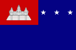
Country - Khmer_Republic
 |
 |
| Flag of Cambodia | |
The main cause of the coup was Norodom Sihanouk's tolerance of North Vietnamese military activity within Cambodia's borders; Vietnamese communist forces had gained de facto control over vast areas of eastern Cambodia as a result. Another important factor was the dire state of the Cambodian economy, an indirect result of Sihanouk's policies of pursuing neutrality.
Currency / Language
| ISO | Currency | Symbol | Significant figures |
|---|---|---|---|
| KHR | Cambodian riel | ៛ | 2 |
| ISO | Language |
|---|---|
| KM | Central Khmer language |
| EN | English language |
| FR | French language |